Tag Archives: Missouri float trip

Operation Clean Stream 2019 on the Meramec River

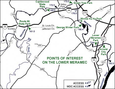
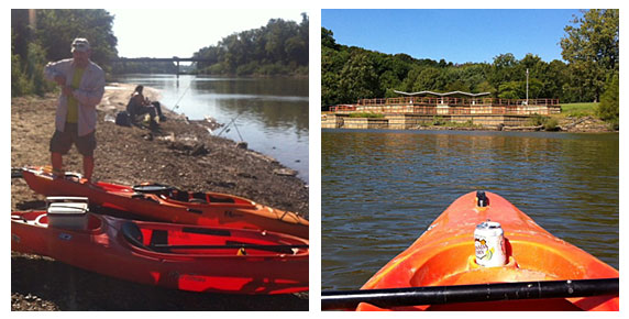
On Saturday, August 24, 2019 Tom and I participated in Operation Clean Stream sponsored by the Open Space Council and many other supporting organizations. I’ve done several of these trash cleanup floats before but this was Tom’s first time. We had a blast because we love to get dirty, we want to do our part to keep our rivers clean and any excuse to get out and be on the water is a good one! We brought our kayaks to the beach on the Meramec River and met up with other volunteers who brought their own vessels. The people I end up floating with on these cleanup days are terrific and we hope we get to float with these folks again. I floated with leader Tim before in 2016 – here is an article I wrote about that day:
Fit and Healthy on Route 66: Two Sections of the Lower Meramec – Part I

untying kayaks at Castlewood State Park
Here is Tom around 7:30 am untying our kayaks that I transported on top of my Jeep. You can tell by his body language he is pretty eager to get started!
unloading the trash
Here is our group’s trash haul in the foreground at Greentree Park in Kirkwood. We were pretty exhausted by this point but the Open Space Council fed us a nice lunch to revive us a little for the trip home! Loading the kayaks is easy in the morning, not so easy in the afternoon!

I took a couple of videos too:

Tom bags a tire:
https://youtu.be/EN4QmrwSWn8

Some of the members of our group share their favorite finds on a sandbar near Highway 141:
https://youtu.be/vrrsEfZF8qg

Water hyacinth I collected on the Meramec River on August 24, 2019.

I found some water hyacinth along the way and picked up as much as I could. I want to use it in our pond which should be finished soon, but even more importantly I want to get it out of the natural body of water because it’s an invasive species. More info about water hyacinth here: http://stopaquatichitchhikers.org/hitchhikers/plants-water-hyacinth/

This is the first time I can recall seeing water hyacinth in a natural body of water in Missouri. Our winters should kill it – that may or may not mitigate the threat – I don’t know.  What if some floats downstream to a warmer state? That’s why I grabbed as much as I could. Here is some Missouri specific information: https://mdc.mo.gov/conmag/2008/01/not-state

Fit and Healthy on Route 66: Two Sections of the Lower Meramec – Part II

Points of interest on the Lower Meramec River

It was only a few days after my participation in Operation Clean Stream on the Meramec River that a fellow member of the St. Louis Adventure Group Meetup suggested a float from Sunset Hills to Arnold. Kelly was trying to experience some sections of the Meramec that he had not yet floated and I’d never been on that stretch either so I agreed to join him on September 2, the Friday before Labor Day.

This part of the Meramec would not be everyone’s idea of a great place to paddle because it doesn’t have the fast-moving crystal clear water that many of our Missouri streams are known for but I enjoy large rivers and bodies of water that require a lot of paddling. I don’t mind semi-urbanized areas because I enjoy exploring around bridges and other large scary structures. When I was a kid, on occasions when my Dad would take us boating on Lake of the Ozarks or Table Rock Lake, if he piloted the boat too close to a dam or bridge I would scream and cry. I don’t scream and cry if I get close to a bridge now but I do get a weird kind of thrill from it. I probably would scream and cry if I got too close to a dam – even the little tiny one at Creve Coeur Lake gives me a queasy feeling!

Kelly’s plan was to meet at what would be our takeout point, Arnold City Park, where his neighbor would meet us to kindly help us with our shuttle. Our put-in point was at Minnie Ha Ha Park in Sunset Hills, a 10 mile float by river but only a 10 minute drive from one point to the other. This route is a very efficient way to get in a lot of paddling for a small expenditure of driving time.

090216

On the left is Kelly with our boats at Minnie Ha Ha Park. Since it was a weekday and the holiday weekend had not started yet there were a few people fishing but not much traffic on the river – most of the time we had it to ourselves with only fish, turtles and birds for company. The picture on the right is of George Winter Park, located where the river bulges out in a strange manner as you can see from the map at the top of this article. Kelly explained that much sand and gravel has been and is being mined from the vicinity causing lake-like sections that are a lot of fun to explore.

090216_2

A few times during the day we pulled onto a gravel bar to stretch our legs a bit or eat lunch. There are banks that are too steep or muddy to climb out of the vessel but also plenty of gravel bars that are just right. The picture on the right shows the Hwy. 21 bridge in the distance. This section was toward the end of our float and we’d been paddling against the wind for quite awhile so a little time to sit back and drift while taking pictures was welcome.

090216_3

This last pair of photos shows the remains of the boat ramp at Arnold City Park on the left and the Lemay Ferry Rd. and Hwy. 55 bridges on the right (the Hwy. 55 bridge is the one in the distance). Flood damage has rendered this boat ramp pretty useless to all but small watercraft like ours. If you can’t hand-carry your boat down to the water look for another boat ramp to use. The rocky shoreline was not that easy to disembark from either, I did it without falling on my butt but it was close. My footwear for the day was imitation Crocs – something sturdier would have been safer for scrambling around on the rocks and debris.

Our float took about five hours including a stop for lunch and maybe an extra hour and a half or so for shuttling, loading and unloading. We could have added more padding miles by more thoroughly exploring all the little coves and inlets but we only did a few. If you float this section, a map would be a good idea because the geography can be confusing. There is not a lot of shade along the way so make sure you have plenty of sunscreen! Watch out for jumping Asian carp – I don’t know if there is anything you can do about them but be aware just in case. None hit me or jumped in my boat but a group splashed me pretty good and put a momentary scare into me! The myriad of parks along the Meramec are worth exploring on foot and by bicycle. The natural flood cycle of a river can take things away but it also gives by making some land suitable for recreation rather than development. Enjoy!

Fit and Healthy on Route 66: Two Sections of the Lower Meramec – Part I

The Lower Meramec River, which runs from Sullivan, MO to the Mississippi River, is not one of the most popular sections to paddle. If you enjoy lake paddling or exploring large rivers, you might want to take another look at the Lower Meramec. I paddled two sections recently and enjoyed it tremendously.

On August 27, 2016 I joined some other volunteers to participate in Operation Clean Stream, sponsored by the Open Space Council. On this day there were several locations we could pick from. I brought my own kayak this time so I chose a route that was not serviced by an outfitter.

I checked in at Castlewood State Park in Wildwood and met a great group of people at the put-in point on the beach. This fun and hard-working group of volunteers and I headed downstream toward our eventual takeout point at Green Tree Park in Kirkwood.

Operation Clean Stream put-in point at Castlwood State Park
At the left is my group getting ready to depart from the Castlewood State Park boat ramp. On the right is a sandbar where we stopped to clean up trash. On the shore you can see a couple of land volunteers.

At one point I had to paddle upstream for awhile to go back to that sandbar because I thought I had lost an item there. It turned out I hadn’t lost it but I did learn one thing – it’s pretty easy to paddle upstream (perhaps up to Route 66 State Park?) so it’s possible to go for a solo paddling outing from here without worrying about a shuttle. Just paddle upstream for awhile then downstream again to get back to your vehicle.

Some interesting bridges
On the left is an interesting bridge that appears to have vegetation growing on top. It’s right before the Hwy. 141 bridge. On the right is the 141 bridge and a railroad bridge just beyond it.

aug27_4

Taking photos like those above could be hazardous to your safety if you are not careful! The current is pretty swift here so I probably should have concentrated on steering the kayak. It was pretty awesome to see all the logs stuck in and on the bridge from the Flood of 2015 which was of historic proportions – can you believe the water got that high? This bridge is not far from Simpson Lake, where I participated in flood cleanup in February.

aug27_3

I’m pictured at the left with Eric and Kim. On the right are Simon and Tim at the takeout point at Greentree Park, displaying part of our haul. It’s only about a six mile float from Castlewood State Park to Greentree, but it took us a good part of the day because we stopped a lot for trash. Trying to retrieve trash from a boat in a current will really test your paddling skills – you have to be able to maneuver in and out of tight spots, enter and exit frequently without tipping, be able to approach and dock alongside obstacles safely and have a good idea how far over you can lean to grab something. You’ll exercise different parts of your body than you’re used to – a great workout!

Stay tuned for Part II – Minnie Ha Ha Park in Sunset Hills to Arnold City Park.

Links to more information:

Operation Clean Stream’s September Newsletter with news of the cleanup – Includes news of a matching grant to benefit the Meramec Route 66 Bridge at Route 66 State Park.

My article about the August 14, 2016 cleanup

Here is a photo of my Dad at the cleanup at North Riverfront Park

My article about Castlewood State Park

Fit and Healthy on Route 66: Operation Clean Stream at Ozark Outdoors in Leasburg

finished_leasburg_map

On August 14, 2016 I joined a number of other paddle sports enthusiasts at Ozark Outdoors Riverfront Resort in Leasburg, MO for a day of cleaning trash from the local streams as part of Operation Clean Stream. We had our choice of different route lengths. I selected the 9 mile route which placed me with a few recreational floaters on the Bluffs section of the Meramec River. Other volunteers who opted for shorter routes were taken to put-in points on the Courtois and Huzzah rivers. Ozark Outdoors provided breakfast, trash bags, vessels, paddling gear and transportation. At the end of the day we dropped off our trash and equipment on the beach at the resort. Since I was the only volunteer to choose the long route, I was one of the last if not THE last to finish.

It rained for nearly the entire day, which I didn’t find to be a bad experience at all. My nylon rain poncho eventually soaked through but it was warm enough for me not to get cold and my torso was warmed by my life jacket. The rain was quite soothing and beautiful and it’s nice to see the river in different conditions. Rainy weather proved to be no impediment to picking up trash, in a way it made it a little more pleasant because at least the trash was fairly clean! Every time I stopped to clean up a sandbar I had to bail out the canoe with a Gatorade bottle that I found but that was no big deal. I didn’t bring my phone because it doesn’t hold a charge very well these days so my only photo of the day is of the trash pile (at the end of this article) when I was able to recharge the phone enough to get a picture. The Ozark Outdoors Facebook Page has some photos of the event.

The Bluffs section is very scenic and I recommend it for a great float. I have floated that stretch before but did not use the same outfitter so my put in and take out points were not the same. Ozark Outdoors used land they own for both so I’m not exactly sure where the put-in point is on the map at the beginning of this article. It was at the former site of a resort called The Bluffs which no longer exists.

Ozark Outdoors is practically right across the river from Onondaga Cave State Park. If you’re camping at the park, the resort has a well-stocked store if you need to make a run for more provisions. The resort is large and has a lot of services – cabins, camping, pay showers, ample restrooms, canoe and kayak rental and more. The staff seemed to be organized, friendly and committed to promoting responsible enjoyment of our streams.

ocs_081416
I found the space helmet and the chair, plus three bags of this trash!

There are more water and land based cleanup opportunities on August 27, 2016 – here is more information if you want to get involved!
Operation Clean Stream August 27
Operation Clean Stream 2016 Facebook Page