Originally published April 15, 2012

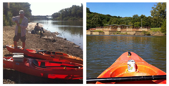
On Saturday, April 7, 2012, I joined members of the St. Louis Adventure Group (SLAG) for a float on the Meramec River. The Meramec is a prominent feature of the Route 66 corridor from Phelps County to St. Louis County, where it makes it’s way toward the Mississippi River. It is visible from Route 66 in St. Louis County and crosses paths at Valley Park and Route 66 State Park. Once you leave St. Louis County you will have to travel a little way off of Route 66 to see the Meramec River at spots such as Onondaga Cave State Park, Meramec State Park or Robertsville State Park. In between the parks are additional points where you can put in and take out boats.
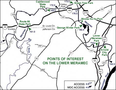
The Missouri Department of Conservation has provided maps to show where the put-in points are. On our April 7 float, we put in at Pacific Palisades Conservation Area (147.3 on the map below) and Allenton Access (154.2).

This was a fairly short float. We stretched it into about three hours by really taking our time. It was also easy – there are only a few spots where you really have to pay attention to navigate around snags that always seem to be right where the current is swiftest! Our group was made up of experienced paddlers but the Meramec River should always be respected regardless of experience level – it is deep and fast enough to drown people, so if you are going to float it please be sober, make sure you can swim, and use a personal floatation device. You might consider carrying a knife on your person to cut yourself free in case you get tangled in anything. Read here for more safety tips and legal guidelines.
After the float, several members of our group headed to Super Smokers (a Route 66 Association of Missouri Business Member) for a delicious BBQ dinner. We were very impressed by the swiftness at which they served our large group. The food was fantastic!
If you would like to try one of Missouri’s many beautiful float streams but don’t own a boat or need a shuttle, check out our list of Business Members – there are a couple of outfitters on there who will happy to tell you about their offerings.
See photos of our float:


